
File:Amtrak network map 2016.png

Size of this preview: 800 × 533 pixels. Other resolutions: 320 × 213 pixels | 640 × 427 pixels | 1,024 × 683 pixels | 1,280 × 853 pixels | 2,560 × 1,707 pixels | 4,800 × 3,200 pixels.
Original file (4,800 × 3,200 pixels, file size: 1.63 MB, MIME type: image/png)
| This is a file from the Wikimedia Commons. Information from its description page there is shown below. Commons is a freely licensed media file repository. You can help. |
Summary
| Description |
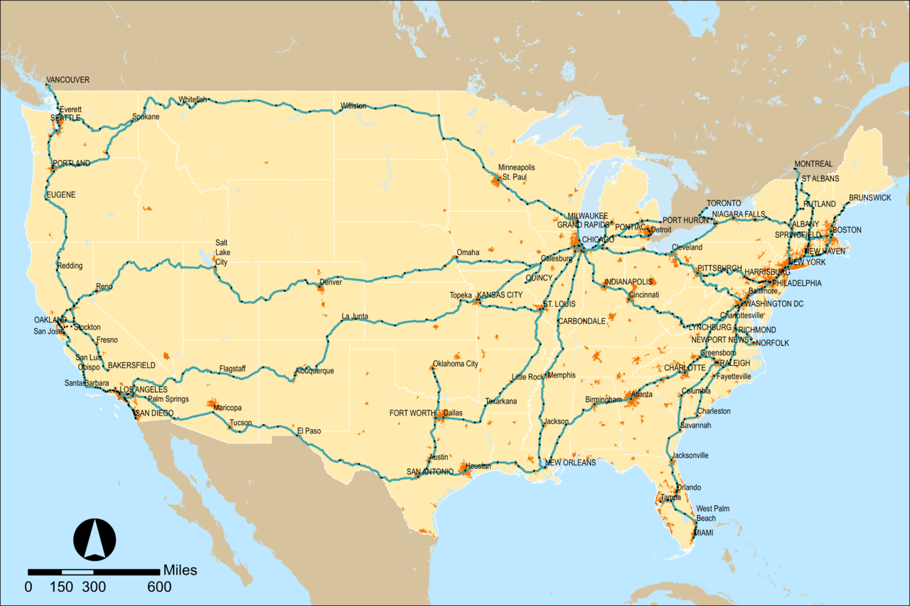
English: Map of Amtrak's rail network as of mid 2016. Updates should be uploaded as separate files rather than overwriting this one. |
|||
| Date | ||||
| Source | PNG render of File:Amtrak network map 2016.svg for article use | |||
| Author | User:Pi.1415926535 | |||
| Other versions |
|


Licensing
I, the copyright holder of this work, hereby publish it under the following license:
This file is licensed under the Creative Commons Attribution-Share Alike 4.0 International license.
- You are free:
- to share – to copy, distribute and transmit the work
- to remix – to adapt the work
- Under the following conditions:
- attribution – You must give appropriate credit, provide a link to the license, and indicate if changes were made. You may do so in any reasonable manner, but not in any way that suggests the licensor endorses you or your use.
- share alike – If you remix, transform, or build upon the material, you must distribute your contributions under the same or compatible license as the original.
File history
Click on a date/time to view the file as it appeared at that time.
| Date/Time | Thumbnail | Dimensions | User | Comment | |
|---|---|---|---|---|---|
| current | 21:01, 18 August 2016 | | 4,800 × 3,200 (1.63 MB) | Pi.1415926535 | Drop urban area threshold to match svg |
| 05:37, 31 July 2016 |  | 4,800 × 3,200 (1.78 MB) | Pi.1415926535 | == {{int:filedesc}} == {{Information |Description ={{en|1=Map of Amtrak's rail network with rail stations (black) and Thruway bus stops (grey) marked. }} |Source =PNG render of File:Amtrak network map 2016.svg for article use |Author... |
File usage
No pages on the English Wikipedia use this file (pages on other projects are not listed).