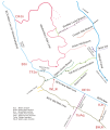
File:BCN canal map Wednesbury Oak.svg
Appearance

Size of this PNG preview of this SVG file: 330 × 390 pixels. Other resolutions: 203 × 240 pixels | 406 × 480 pixels | 650 × 768 pixels | 866 × 1,024 pixels | 1,733 × 2,048 pixels.
Original file (SVG file, nominally 330 × 390 pixels, file size: 75 KB)
File history
Click on a date/time to view the file as it appeared at that time.
| Date/Time | Thumbnail | Dimensions | User | Comment | |
|---|---|---|---|---|---|
| current | 20:21, 18 October 2007 |  | 330 × 390 (75 KB) | Oosoom | == Summary == {{Information |Description=Schematic map of the Wednesbury Oak Loop and its neighbouring canals of the Birmingham Canal Navigations (BCN), [[:en:West Midlands (county)|West Mid |
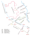
| 11:30, 18 October 2007 |  | 1,800 × 2,100 (71 KB) | Oosoom | == Summary == {{Information |Description=Schematic map of the Wednesbury Canal and its neighbouring canals, West Midlands, England. |Source=self-made from expired-copyright Ordnance Survey map SO99SE |
File usage
The following 6 pages use this file:
