
File:Baldcypress range.jpg
Size of this preview: 457 × 600 pixels. Other resolutions: 183 × 240 pixels | 366 × 480 pixels | 640 × 840 pixels.
Original file (640 × 840 pixels, file size: 93 KB, MIME type: image/jpeg)
| This is a file from the Wikimedia Commons. Information from its description page there is shown below. Commons is a freely licensed media file repository. You can help. |
Summary
| Description |
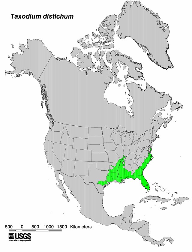
English: Flora distribution map Bald Cypress (Taxodium distichum) tree.
|
| Date | No clue when it was produced by the USGS - I'm uploading it here 5/25/09 |
| Source | USGS |
| Author | USGS |


Licensing
This image is in the public domain in the United States because it only contains materials that originally came from the United States Geological Survey, an agency of the United States Department of the Interior. For more information, see the official USGS copyright policy.
|
Original upload log
Transferred from en.wikipedia to Commons by Sreejithk2000 using CommonsHelper.
The original description page was here. All following user names refer to en.wikipedia.
- 2009-05-25 18:58 Nuberger13 640×840× (94968 bytes) {{Information |Description = Map showing the range of the baldcypress tree |Source = USGS |Date = No clue when it was produced by the USGS - I'm uploading it here 5/25/09 |Author = USGS |Permission = PD |other_versio
File history
Click on a date/time to view the file as it appeared at that time.
| Date/Time | Thumbnail | Dimensions | User | Comment | |
|---|---|---|---|---|---|
| current | 07:47, 1 June 2010 | | 640 × 840 (93 KB) | File Upload Bot (Magnus Manske) | {{BotMoveToCommons|en.wikipedia|year={{subst:CURRENTYEAR}}|month={{subst:CURRENTMONTHNAME}}|day={{subst:CURRENTDAY}}}} {{Information |Description={{en|Map showing the range of the baldcypress tree}} |Source=Transferred from [http://en.wikipedia.org en.wi |
File usage
The following 2 pages use this file:
Global file usage
The following other wikis use this file:
- Usage on ceb.wikipedia.org
- Usage on eo.wikipedia.org
- Usage on he.wikipedia.org
- Usage on hu.wikipedia.org
- Usage on is.wikipedia.org
- Usage on lt.wikipedia.org
- Usage on ru.wikipedia.org
- Usage on tr.wikipedia.org
- Usage on war.wikipedia.org