
File:EF2 damage in Terese, Alabama.jpg
Size of this preview: 800 × 600 pixels. Other resolutions: 320 × 240 pixels | 640 × 480 pixels | 1,024 × 768 pixels | 1,280 × 960 pixels.
Original file (1,280 × 960 pixels, file size: 1.12 MB, MIME type: image/jpeg)
| This is a file from the Wikimedia Commons. Information from its description page there is shown below. Commons is a freely licensed media file repository. You can help. |
Summary
| Description |
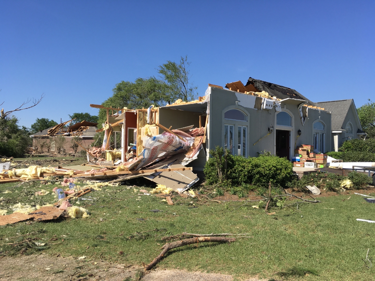
English: Extensive high-end EF2 damage to a home in Terese, Alabama south of Eufaula. Other homes in the photo suffered EF1-EF2 level damage. |
| Date | |
| Source | https://services.dat.noaa.gov/arcgis/rest/services/nws_damageassessmenttoolkit/DamageViewer/FeatureServer/0/2063192/attachments/1288283 |
| Author | NWS Birmingham, Alabama |
Licensing
This file is in the public domain in the United States because it was solely created by employees of the National Weather Service or National Severe Storms Laboratory using the Damage Assessment Toolkit (DAT), an interactive map and database.
|
File history
Click on a date/time to view the file as it appeared at that time.
| Date/Time | Thumbnail | Dimensions | User | Comment | |
|---|---|---|---|---|---|
| current | 15:44, 23 February 2021 | | 1,280 × 960 (1.12 MB) | ChessEric | Uploaded a work by NWS Birmingham, Alabama from https://services.dat.noaa.gov/arcgis/rest/services/nws_damageassessmenttoolkit/DamageViewer/FeatureServer/0/2063192/attachments/1288283 with UploadWizard |
File usage
The following 2 pages use this file: