
File:Hungary with Turky in Europe.jpg
Size of this preview: 731 × 600 pixels. Other resolutions: 293 × 240 pixels | 585 × 480 pixels | 936 × 768 pixels | 1,248 × 1,024 pixels | 2,496 × 2,048 pixels | 2,676 × 2,196 pixels.
Original file (2,676 × 2,196 pixels, file size: 288 KB, MIME type: image/jpeg)
| This is a file from the Wikimedia Commons. Information from its description page there is shown below. Commons is a freely licensed media file repository. You can help. |
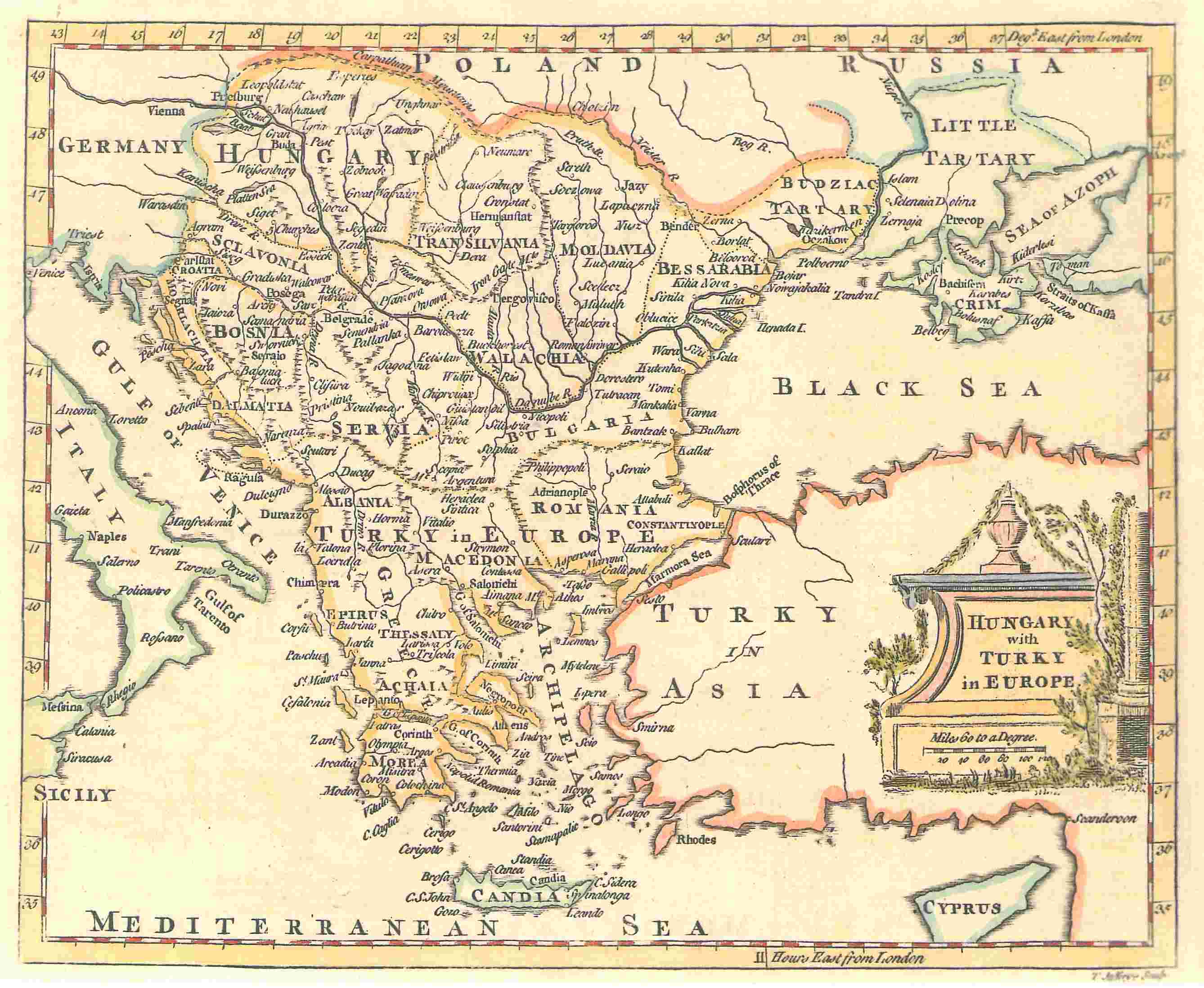
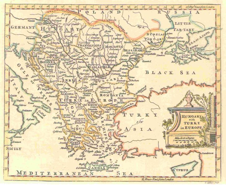
A map by T. Jefferys, 1785
The map shows Hungary and the bordering Balkan regions controlled by the Ottoman Empire.
The owner of the map agrees to the image being displayed in Wikipedia. All other ways of using this image should be disussed with User:KIDB
|
This work is in the public domain in its country of origin and other countries and areas where the copyright term is the author's life plus 70 years or fewer. | |
| This file has been identified as being free of known restrictions under copyright law, including all related and neighboring rights. | |


File history
Click on a date/time to view the file as it appeared at that time.
| Date/Time | Thumbnail | Dimensions | User | Comment | |
|---|---|---|---|---|---|
| current | 22:00, 19 November 2006 | | 2,676 × 2,196 (288 KB) | Electionworld | '''A map by T. Jefferys, 1785''' <br><br> The map shows Hungary and the bordering Balkan regions controlled by the Ottoman Empire. <br><br> ''The owner of the map agrees to the image being displayed in Wikipedia. All other ways of using this image should |
File usage
The following 9 pages use this file:
Global file usage
The following other wikis use this file:
- Usage on fr.wikipedia.org
- Usage on ko.wikipedia.org
- Usage on ro.wikipedia.org