
File:South Georgia location map.svg

Size of this PNG preview of this SVG file: 764 × 600 pixels. Other resolutions: 306 × 240 pixels | 612 × 480 pixels | 979 × 768 pixels | 1,280 × 1,005 pixels | 2,560 × 2,009 pixels | 776 × 609 pixels.
Original file (SVG file, nominally 776 × 609 pixels, file size: 24 KB)
| This is a file from the Wikimedia Commons. Information from its description page there is shown below. Commons is a freely licensed media file repository. You can help. |
Summary
| Description |
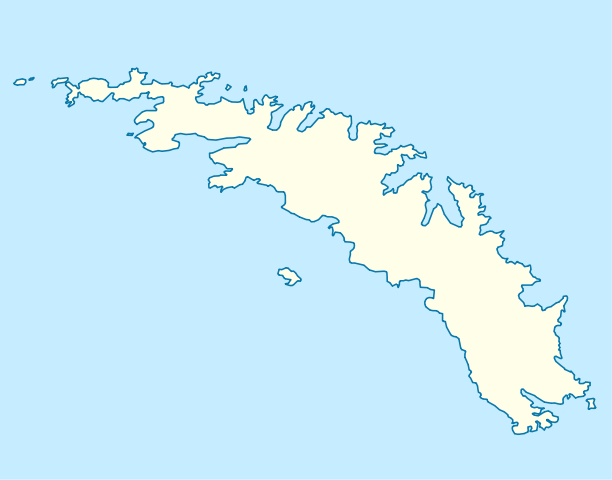
Deutsch: Positionskarte von Südgeorgien
Quadratische Plattkarte, N-S-Streckung 170 %. Geographische Begrenzung der Karte:
English: Location map of South Georgia
Equirectangular projection, N/S stretching 170 %. Geographic limits of the map:
|
||
| Date | |||
| Source | own work, using United States National Imagery and Mapping Agency data | ||
| Author | NordNordWest |

Licensing
I, the copyright holder of this work, hereby publish it under the following licenses:

|
Permission is granted to copy, distribute and/or modify this document under the terms of the GNU Free Documentation License, Version 1.2 or any later version published by the Free Software Foundation; with no Invariant Sections, no Front-Cover Texts, and no Back-Cover Texts. A copy of the license is included in the section entitled GNU Free Documentation License. |
This file is licensed under the Creative Commons Attribution 3.0 Unported license.
- You are free:
- to share – to copy, distribute and transmit the work
- to remix – to adapt the work
- Under the following conditions:
- attribution – You must give appropriate credit, provide a link to the license, and indicate if changes were made. You may do so in any reasonable manner, but not in any way that suggests the licensor endorses you or your use.
You may select the license of your choice.
File history
Click on a date/time to view the file as it appeared at that time.
| Date/Time | Thumbnail | Dimensions | User | Comment | |
|---|---|---|---|---|---|
| current | 07:51, 31 March 2009 | | 776 × 609 (24 KB) | NordNordWest | corr |
| 08:06, 30 March 2009 |  | 824 × 609 (24 KB) | NordNordWest | {{Information |Description= {{de|Positionskarte von Südgeorgien}} Quadratische Plattkarte, N-S-Streckung 170 %. Geographische Begrenzung der Karte: * N: 53.8° S * S: 55.0° S * W: 38.0° W * O: 35.7° W {{en|Location map of [[:en:So |
File usage
The following pages on the English Wikipedia use this file (pages on other projects are not listed):
Global file usage
The following other wikis use this file:
- Usage on az.wikipedia.org
- Usage on eo.wikipedia.org
- Usage on es.wikipedia.org
- Grytviken
- Puerto Leith
- Stromness (Georgia del Sur)
- Husvik
- Wikiproyecto:Ilustración/Taller de Cartografía/Realizaciones/Antártida
- Wikiproyecto:Islas del Atlántico Sur
- Puerto del Príncipe Olav
- Puerto Rosita
- Puerto Nueva Fortuna
- Buen Arroyo
- Lago Gaviota (Georgia del Sur)
- Plantilla:Mapa de localización de Georgia del Sur
- Base King Edward Point
- Wikiproyecto:Ilustración/Taller de Cartografía/Solicitudes/Archivo2
- Usage on fr.wikipedia.org
- Usage on he.wikivoyage.org
- Usage on hy.wikipedia.org
- Usage on os.wikipedia.org
- Usage on ru.wikipedia.org
- Usage on uk.wikipedia.org