
Laurel Hill station
Laurel Hill | |||||||||||
|---|---|---|---|---|---|---|---|---|---|---|---|
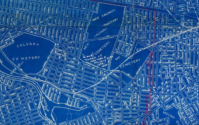
 An 1891 map of the area which included of the former Laurel Hill Station. | |||||||||||
| General information | |||||||||||
| Location | Clifton Street Long Island City, Queens, New York | ||||||||||
| Coordinates | 40°43′36.38″N 73°55′24.91″W / 40.7267722°N 73.9235861°W | ||||||||||
| Owned by | LIRR | ||||||||||
| Line(s) | Montauk Branch | ||||||||||
| Platforms | 2 side platforms[citation needed] | ||||||||||
| Tracks | 2[1] | ||||||||||
| History | |||||||||||
| Opened | 1890[dubious – discuss] | ||||||||||
| Closed | c.1900[dubious – discuss] | ||||||||||
| Electrified | August 29, 1905[citation needed] | ||||||||||
| Former services | |||||||||||
| |||||||||||
Laurel Hill was a railroad station on the Lower Montauk Branch of the Long Island Rail Road in Long Island City, New York. It existed briefly around the 1880s[1] and was located where Clifton Street (now 46th Street) used to intersect the railroad line.[2][1]
Laurel Hill station was located a few blocks west of the point where the former junction between the New York and Flushing Railroad and South Side Railroad of Long Island existed.[3] It was built by the LIRR[dubious – discuss] in 1890[dubious – discuss]. The station was relatively short-lived and closed in September 1892[1] or around 1900.[2] However, also in September 1892, the new Haberman station opened only a short distance to the east.[4]
In 1905, the junction was closed for passenger service.[citation needed] Industrialization of Long Island City and the altering of both street names and street patterns (in this case by the Phelps Dodge Copper Refining and Chemical Plant) have removed all traces of the former station[citation needed], which, relative to the 21st-Century street grid, would have been along 56th Road halfway between 43rd and 48th Streets.
References
[edit]- ^ a b c d Arthur John Huneke (March 2006). "HP&SSRR". aRRt's aRRchives. Archived from the original on 2024-04-15. Retrieved 2024-10-04.
WHEN THE BROOKLYN & MONTAUK RAILROAD DOUBLETRACKED THIS LINE IN 1880 […] LOOKING NORTH JUST SOUTH OF CLIFTON AVENUE (46th STREET) IN 1910. IN THE 1880'S AND UNTIL SEPTEMBER 1892, THIS WAS THE LOCATION OF LAUREL HILL STATION.
{{cite web}}: External link in|website= - ^ a b "LIRR Station History (TrainsAreFun.com)". Archived from the original on 2017-05-26. Retrieved 2011-06-14.
- ^ 1924 Long Island Railroad Corporate Blueprint (Arrt's Arrchives)
- ^ Seyfried, Vincent F. (1975). "Station List". The Long Island Rail Road: A Comprehensive History (pdf). Vol. 6: The Golden Age 1881–1900. Garden City, New York: self-published. p. 266. LCCN 61-17477. OCLC 192099519. Archived from the original on 2015-04-19 – via Queens Public Library.
External links
[edit]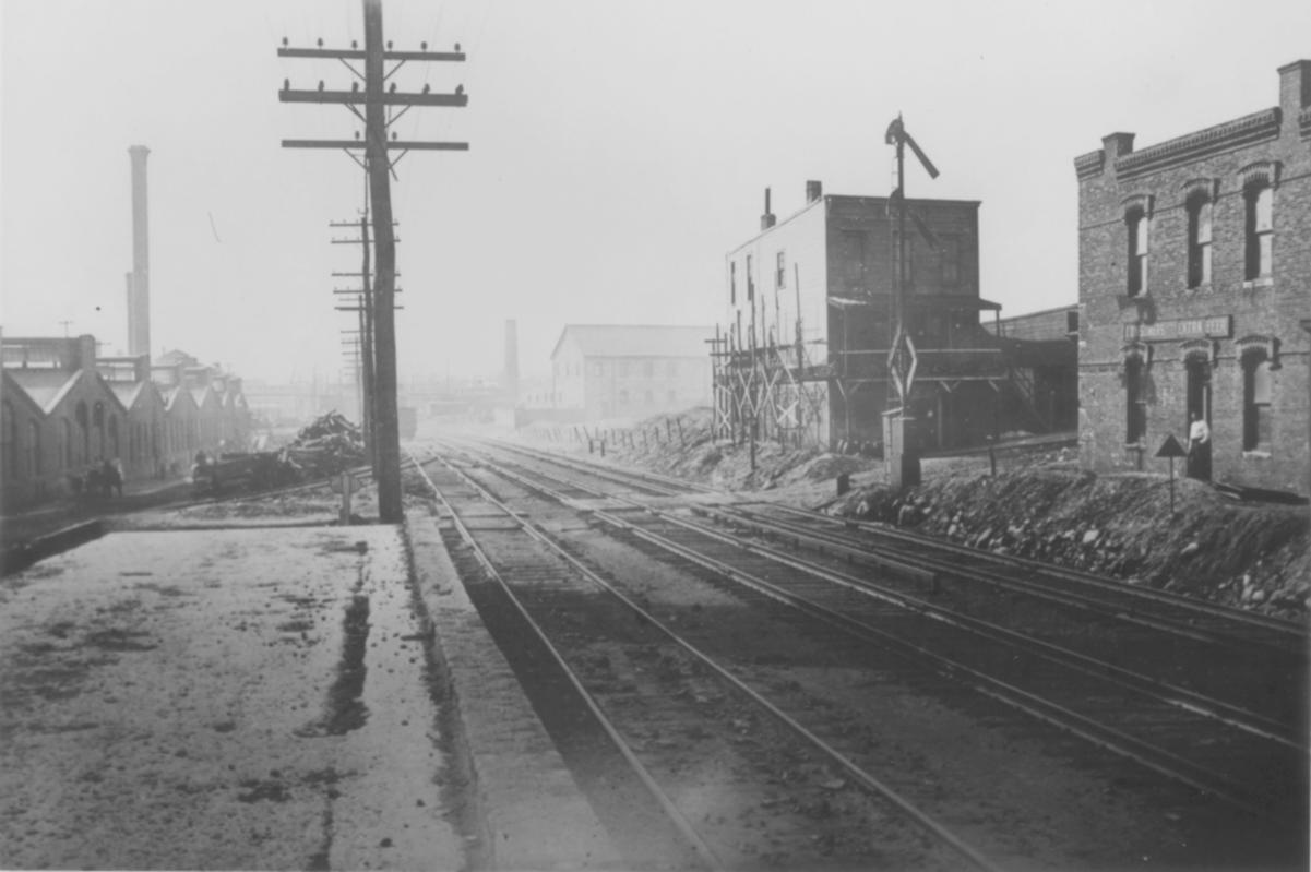
This Queens train station–related article is a stub. You can help Wikipedia by expanding it. |
- Former Long Island Rail Road stations in New York City
- Railway stations in Queens, New York
- Railway stations in the United States opened in 1890
- 1890 establishments in New York (state)
- 1900 disestablishments in New York (state)
- Demolished railway stations in the United States
- Railway stations in the United States closed in 1900
- New York City railway station stubs
- Queens, New York building and structure stubs