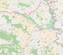
Đurđenovac
Appearance
Đurđenovac | |
|---|---|
 | |
| Coordinates: 45°32′N 18°03′E / 45.54°N 18.05°E | |
| Country | |
| County | |
| Government | |
| • Mayor | Hrvoje Topalović |
| Area | |
| • Municipality | 116.4 km2 (44.9 sq mi) |
| • Urban | 7.2 km2 (2.8 sq mi) |
| Population (2021)[2] | |
| • Municipality | 5,332 |
| • Density | 46/km2 (120/sq mi) |
| • Urban | 2,318 |
| • Urban density | 320/km2 (830/sq mi) |
| Time zone | UTC+1 (Central European Time) |
| Website | djurdjenovac |
Đurđenovac (Hungarian: Gyurgyenovác) is a municipality in Slavonia, in the Osijek-Baranja County of Croatia.
At the 2011 census, there were a total of 6,750 inhabitants in the entire municipality, in the following settlements:[3]
- Beljevina, population 712
- Bokšić, population 433
- Bokšić Lug, population 259
- Đurđenovac, population 2,944
- Gabrilovac, population 63
- Klokočevci, population 428
- Krčevina, population 115
- Ličko Novo Selo, population 96
- Lipine, population 68
- Našičko Novo Selo, population 344
- Pribiševci, population 390
- Sušine, population 278
- Šaptinovci, population 543
- Teodorovac, population 77
By ethnicity, 96.6% of the population was Croat, 1.9% was Serb.[4]
Colonist settlement of Ličko Novo Selo was established during the land reform in interwar Yugoslavia.[5]
References
[edit]- ^ Register of spatial units of the State Geodetic Administration of the Republic of Croatia. Wikidata Q119585703.
- ^ "Population by Age and Sex, by Settlements" (xlsx). Census of Population, Households and Dwellings in 2021. Zagreb: Croatian Bureau of Statistics. 2022.
- ^ "Population by Age and Sex, by Settlements, 2011 Census: Đurđenovac". Census of Population, Households and Dwellings 2011. Zagreb: Croatian Bureau of Statistics. December 2012.
- ^ "Population by Ethnicity, by Towns/Municipalities, 2011 Census: County of Osijek-Baranja". Census of Population, Households and Dwellings 2011. Zagreb: Croatian Bureau of Statistics. December 2012.
- ^ Šimončić-Bobetko, Zdenka (1990). "Kolonizacija u Hrvatskoj 1919.—1941. godine" [Colonization in Croatia Between 1919 and 1941]. Povijesni prilozi (in Croatian). 9 (9). Zagreb: Hrvatski institut za povijest: 160–162. ISSN 0351-9767.


